Geotechnical data
Type of resources
Topics
Keywords
Contact for the resource
Provided by
Years
Formats
Representation types
Update frequencies
-

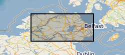
Site investigation and geotechnical data received by the Geological Survey of Northern Ireland (GSNI) from 3rd party organisations in AGS file format. This data has been collected under the Northern Ireland Pan Government Collaborative Framework Agreement (www.bgs.ac.uk/gsni/ags/). Once received by GSNI, the data is validated against predefined rules, processed and stored in the AGS agnostic database store. This data is then delivered as received e.g. no interpretative values or observations are added to the data by the GSNI. For more details about the Association of Geotechnical & Geoenvironmental Specialists (AGS) see: https://www.ags.org.uk
-

This data pack contains information from geotechnical and contaminated land investigations carried out at potential sites for the development of the UK Geoenergy Observatory in Cheshire. Following these investigations, a decision was made to move the proposed observatory to Thornton Science Park. None of the sites discussed in this data pack are in scope for development as part of the Cheshire Observatory. In total 16 holes were drilled using a variety of techniques. The only hole to be drilled using rotary coring was BHA-101. This borehole was cored extensively and logged with wireline geophysical tools. As such this is the main focus of the data pack. BHA-101 was drilled to TD of 121.2 m between 19-Nov-2020 and 09-Dec-2020. Drill core was collected from 51 m – 121 mm with 100 mm diameter. This initial data release pack from BGS contains composite and digital wireline logs alongside daily driller's borehole records.
 BGS Data Catalogue